Concert for Geographic Information Systems Professionals(GISP) - Segmentation Violation


I used #ArcGIS and geoprocessing to plan possible venues for a concert for Geographic Information Systems Professionals(GISP) fans named "Segmentation Violation". Goal was to find the state with the most GISP professionals to host a concert and then find possible venues for that state with the following restrictions:
1) Venues should be in an outside amphitheater atmosphere.
2) There should be large number of professionals near the venue location.
3) Should be close to International Airport.
4) Should be near to an interstate for easy access and transport.
5) There should be hotel nearby for accommodation.
1) Venues should be in an outside amphitheater atmosphere.
2) There should be large number of professionals near the venue location.
3) Should be close to International Airport.
4) Should be near to an interstate for easy access and transport.
5) There should be hotel nearby for accommodation.
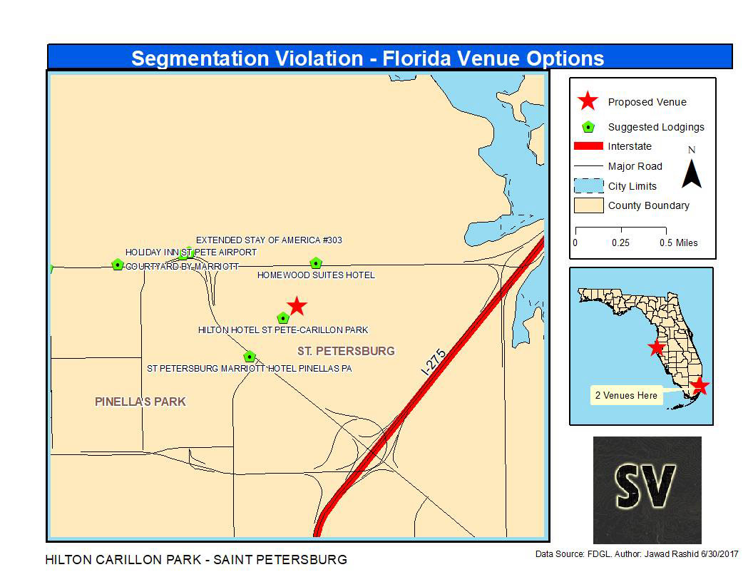
First i downloaded GISP professionals geo database from GISCI website. Once i got that i plotted them on the map. This data had only zip code information. In order to find the state with the most GISP professionals i Zip Code and State boundary files from US Census Bereau in order to merge state data with zip code. Finally once i got this data i used to merge it with GISP dataset in order to find where in which states GISP professionals were located.
Once all of this was done i was able to summarize GISP professionals by states and found out that Florida had the most GISP professionals. I used this information to focus my analysis to Florida. Next, i downloaded Florida boundary information, hotels, major roads, airports, civic centers and city limits from Florida Geographic Data Library(FGDL) in order to find venues from civic centers which met the criteria i needed. Then i step by step narrowed down the results by using distance radius and other attributes to narrow down venues options to only top 3 options which fulfilled our criteria.
Once that is done i was able to find to calculate a lot of information such as distance of each venue from airports, interstate, nice hotels etc to limit to find best venue. These images show case these 3 best venues for the concert. This was all done using data downloaded from various GIS websites and geoprocessing was used to answer important question where to host the event.


